
Drones for Inspections
Performing an inspection with a drone allows you to simultaneously improve cost, safety and completion time. Usually you can only optimize one or two of these variables, but drones have advanced so far that you can maximize all of these factors and greatly enhance the overall experience of inspecting with a drone. Models like the rugged, professional DJI Matrice 300 RTK can be outfitted with a variety of cameras and sensors that make drone inspections a game-changer for the industry.
Insurance Inspections with a Drone
Drones help insurance adjusters by climbing places too high to easily reach, or surveying large areas, or even venturing into locations rendered impassable by fallen debris. Claims adjustments most frequently occur after a storm or other natural disaster, so the utility of a drone that can quickly survey the damage both from long distance—and in close up detail—is unsurpassed.
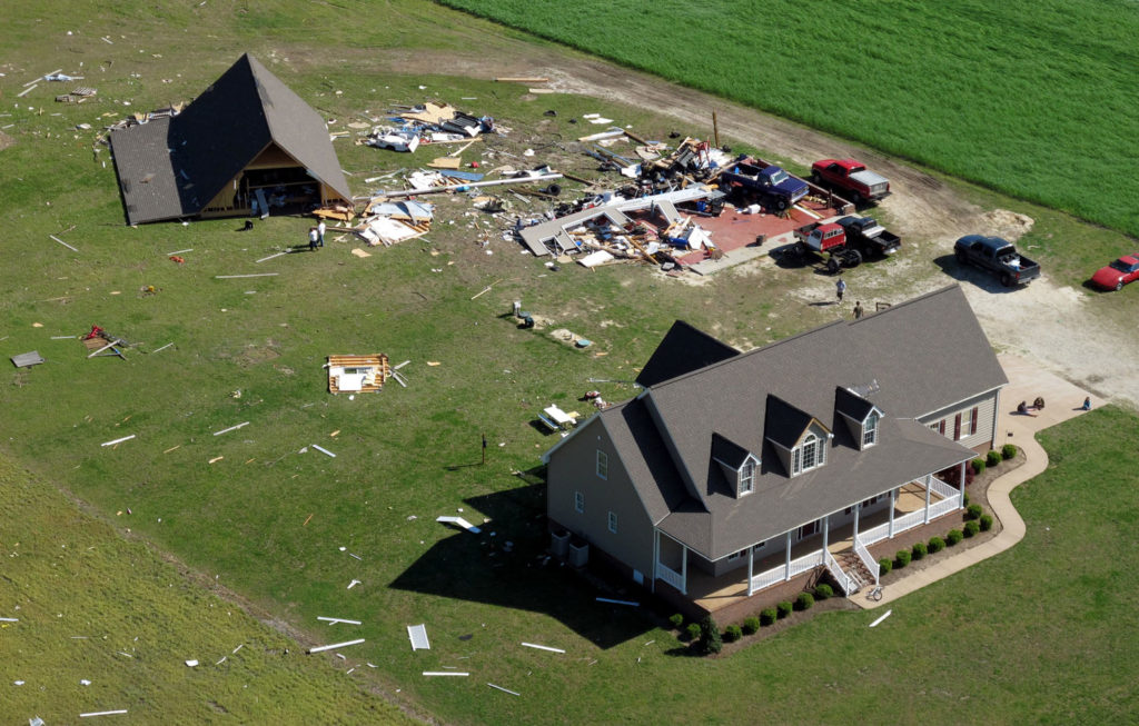
Using Drones to Survey an Entire Area
Because drones can automatically fly a preprogrammed course and take images at fixed intervals, they can quickly cover an entire area with high resolution photos. Satellite or manned aircraft imagery wouldn’t be possible on such a tight timeline after a disaster, whereas drones can be deployed immediately after the storm is over. Units such as the DJI Air 2S or Autel Robotics Nano+ are small enough that an entire fleet can be stored in the trunk of a car so that a team of adjusters can begin reaching all their affected clients within just a few hours after the disaster.
GETTING UP CLOSE
When the damaged area has been checked out, or even in an area without a widespread disaster, drones are crucial to inspecting hard-to-reach places faster and safer than previously possible. Some sites that were formerly accessible only with special equipment are now quick and easy to thoroughly examine with a drone from a very close distance. The insurance personnel profiled in this USA Today article on drone inspections have seen an overall time decrease of 2X-3X versus previous manual techniques when doing this kind of up-close work.
Cellular Tower Inspections
We now take for granted that we’ll have cell service almost everywhere we travel, but we rarely think about the complex infrastructure of tens of thousands of cell phone towers needed to support our roaming freedom. Ranging from just a few stories to as tall as a skyscraper, the expensive equipment on these towers needs to be cataloged, inspected, and maintained every year. Drones provide the perfect solution: no one needs to risk a long, tiring climb just to read serial numbers and check for lightning damage. Instead, drones can ascend to the tower in a few seconds and record every detail with high resolution zoom cameras like the DJI Zenmuse H20T or the DJI Matrice 30T
New automated software like Drone Harmony is making the entire process even simpler. The whole cell tower can be captured in a single flight as a tiny phone app precisely calculates the perfect spiral trajectory to record images that fully document every inch of a tower. The entire flight and all imaging can take as little as 5 minutes, which is faster than putting on a climbing harness! With amazing automation like this, a single inspector can cover dozens of towers in a single day.
Residential and Commercial Roofs
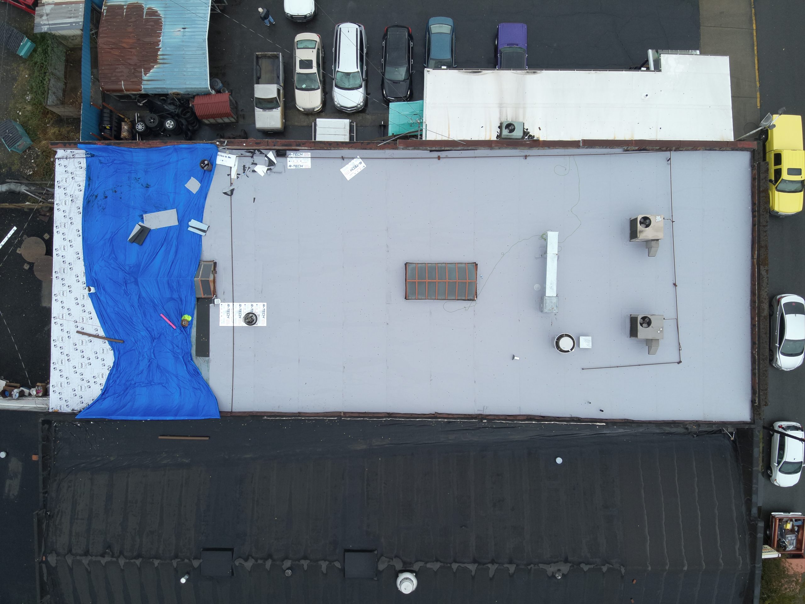
Nothing strikes terror in the heart of a homeowner like the words “you need to replace your roof.” Fortunately, a good pre-purchase inspection usually covers the entire roof, and now home inspectors across the nation are leaving their ladders behind while they look for damage from a safe spot on the ground. Larger roofs on commercial buildings are easy to inspect with a drone as well, using the same automated mapping techniques you’d use to stitch together a ground survey. Even angled roofs can be dealt with easily as you construct a 3D model by making two successive passes, one with the camera straight down, another at an angle. These breathtakingly accurate measurements mean less waste in supplies, better documentation for records, and lower uncertainty for job costing and time estimation.
Checking for Energy Leaks
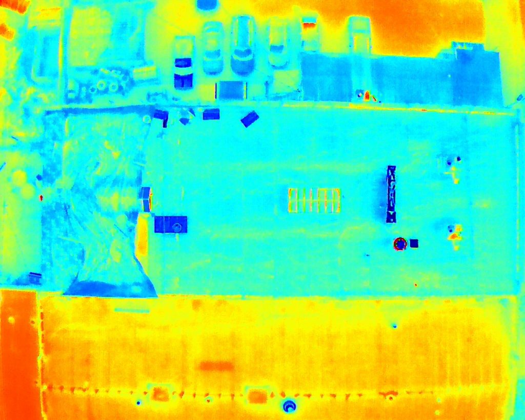
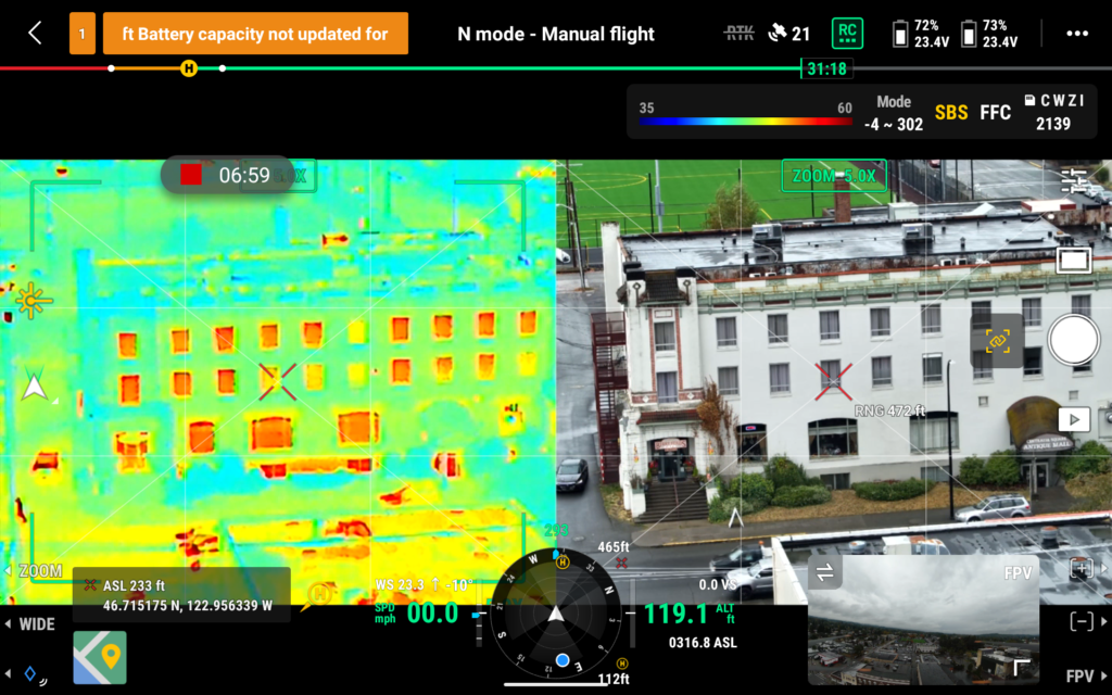
Another fantastic feature of drones is their ability to carry infrared cameras that can detect heat loss. Cameras like the visible/infrared DJI Matrice 30T or DJI Zenmuse H20T allow every leaky window, vent, and external wall to show up on an inspector’s report so that repairs can be made and energy saved. Each temperature change can be coded to show up in a brightly contrasting color so that home or commercial inspectors can quickly diagnose problems from afar.
Air Quality Inspections
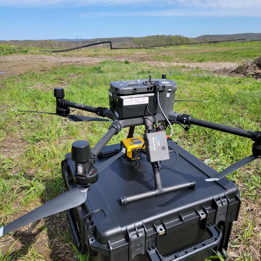
More than just showing heating and cooling losses, inspectors from environmental agencies or local governments can actually use drones to monitor air quality in real time. Sensors like the Laser Falcon can sample atmospheric gases hundreds of feet in the air or just a few feet above ground. The Laser Falcon is especially useful to detect industrial leaks or verify that methane capture tools at concentrated animal feeding operations (CAFOs) are working as designed. Rugged high-payload solutions like the DJI Matrice 300 can carry these sensors and others in the future as designs are adapted to be flight tolerant.
