Finding Missing People, Kids and Pets from the Air
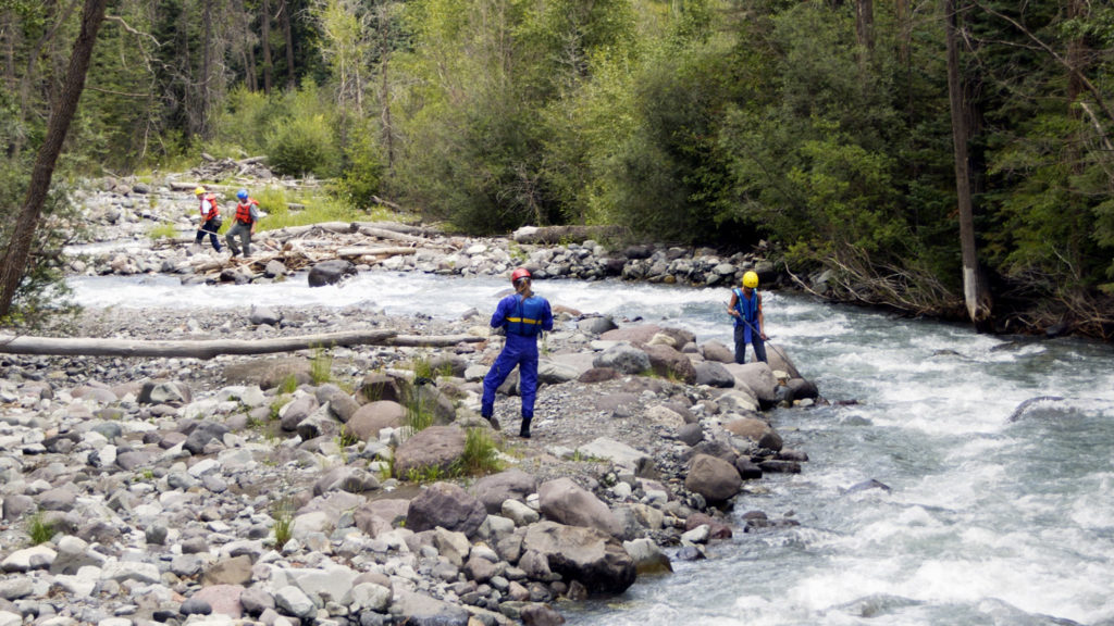
Drones have quickly become an irreplaceable tool for search and rescue teams everywhere. Whether it’s helping locate lost hikers, find missing animals and kids, or even helping adults with memory loss find their way home, drones can assist.
The value of the drones for search and rescue teams really shows in three main areas: responding quickly at a low cost, allowing the use of sensors such as thermal imaging and zoom cameras, and providing automated search coverage of a precise grid.
Local police and volunteer SAR teams have long relied on helicopters and airplanes to aid in locating missing persons, but these options are both expensive and slow. In contrast, drones like the Autel Robotics EVO 2 Dual are ready to fly in minutes, at a fraction of the cost of manned aircraft. These small and compact drones are easier to fly and allow you to have both high resolution thermal and high resolution RGB imagery.
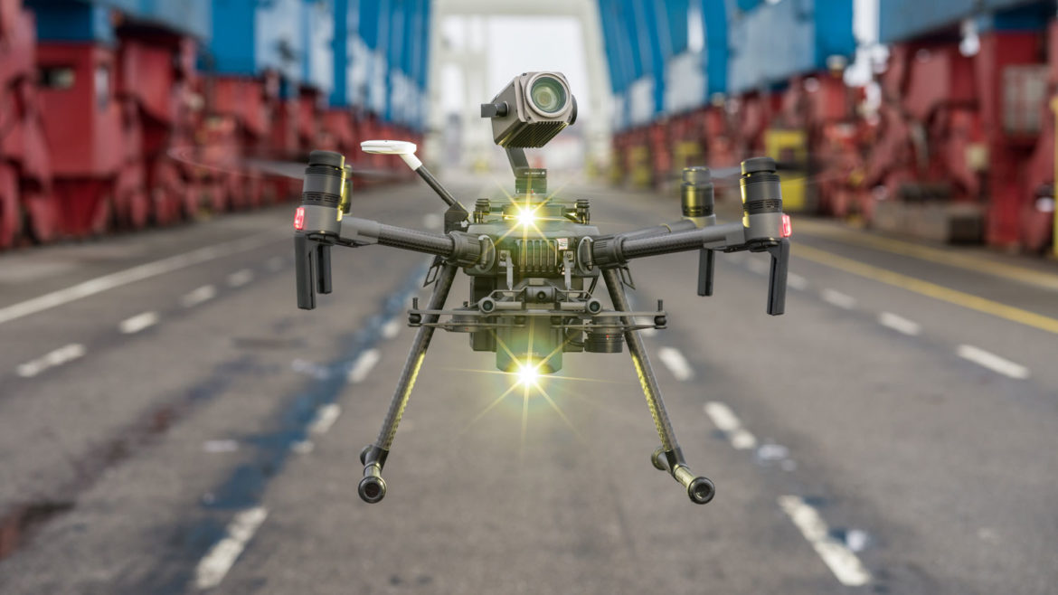
Some larger drones, like the DJI Matrice 300 and DJI Matrice 30, can carry both thermal and visual sensors, meaning that you can locate people under almost any conditions. Flying with two distinct sensors together allows viewing both heat signatures and visible information, like body heat in a forest or a hunter’s orange cap on a snowy mountain. Both series drones have 200x digital zoom and 16x thermal zoom.
When you need an exhaustive search pattern to guide your team’s ground crews, even lost-cost drones such as the Phantom 4 series can automatically fly a precise grid over several square miles while capturing still or video images. You can then view the footage live or downloaded and be assured that you’re searching in a systematic, logical way. This is just one of the many options for a low-cost search and rescue drone, so contact us today to learn more.
How Does a Thermal Imaging Drone Work?
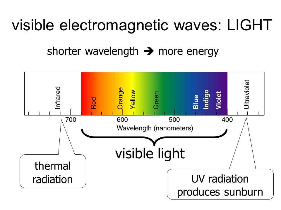
Our eyes see just a small section of all the electromagnetic waves around us. We call this portion “visible light,” and each range of the spectrum is assigned a name you’re familiar with: red, orange, yellow, green, blue, etc. But what’s above and below this visible chunk of the spectrum? You’re no doubt familiar with many of the invisible portions, even though you’ve never seen them: microwaves, radio waves, X-Rays, ultraviolet, and other too numerous to name.
Back To The Whiteboard
How can these concepts from your high school physics class help us see a person’s body heat in a dense forest? It turns out that just above visible light–with wavelengths longer than red light–is the infrared spectrum that contains the waves responsible for propagating heat. You’ve probably seen an iron rod heated until it glows orange, the light fading away as it cools. But even though the visible orange color is gone, the rod is still several hundred degrees (don’t touch!) and is radiating heat in the infrared spectrum. The visible colored light is gone, but the thermal light is still present and detectable by a thermal imaging drone.
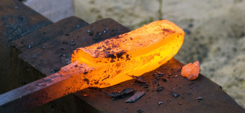
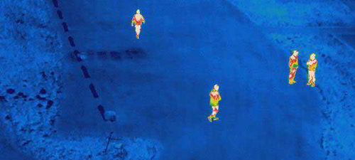
A drone’s thermal sensor can see this hot iron and show it in a different color, just like when it was still glowing-orange hot. Less dramatically, search and rescue drones pinpoint your body’s heat, close to 100º F, and shade it in a different color that easily contrasts with the cold forest floor.
What’s the Difference Between Thermal Imaging and Night Vision?
Night vision cameras rely on magnifying available light and displaying it back to you. Since night vision relies on reflected light, there has to be some available light, such as the moon or a street lamp, or you can’t see a subject at all.
Instead, a thermal imaging drone can see in total darkness because it’s relying on heat generated by the subject itself, whether it’s a warm-blooded animal (sadly, snakes are tough to spot on thermal cameras) or a leaking window that’s wasting your your energy bill. The thermal camera won’t show objects through the glass, but you can detect which parts of the window are hotter and colder, pinpointing any broken seals or poorly fitting frames that are leaking air.
Finally, unlike the magical imaging tools they use on the police dramas you see on your favorite streaming video service, a drone won’t allow you to watch thermal activity inside a house–you’ll need a more powerful, heavy standalone unit and possibly direct contact to see through walls.
Best Drones for Search and Rescue
The DJI Matrice 300 is by far the most flexible, configurable choice that lets you conquer a variety of mission profiles and field scenarios. You can event rent it as a pre-configured bundle with two cameras, one thermal and one zoom.
The DJI Matrice 300 can be configured with a single sensor (H20T) that has both RGB and Thermal imagery along with a laser range finder than can pin-point the latitude and longitude up to 3000 feet away.

The Matrice 30T offers a similar payload with 200x zoom and high resolution thermal camera but adds in a waterproof drone, sensor and smart controller for easier control and capabilities.
Compact Thermal Drones
The Mavic 3 Thermal is a compact drone with both RGB and High Resolution Thermal imagery. The Mavic 3 Thermal also provides you with 45 minutes of flight time and grid flight capabilities.

If you want another versatile drone, the EVO 2 Dual 640T Enterprise has the Thermal and RGB imagery but comes in a bright orange and has a speaker and lights as changeable modules.

The last and latest option is the EVO MAX 4T. This is just slightly larger than the EVO II Series. The EVO Max 4T brings powerful technologies and advanced autonomy to users. EVO Max 4T assesses complex environments to create real-time 3D flight paths for unparalleled obstacle avoidance. Advanced sensors make flight in GPS unavailable areas possible and the incredible new thermal payload unlocks new object identification and tracking scenarios. With a foldable, weather-resistant design, the EVO Max 4T is as portable as it is capable.
The very nature of SAR operations is entirely unpredictable. You can be responding to a flood disaster one week and a searching for a wandering toddler the next. The key to any purchase is maximizing your flexibility so that you can respond well to any contingency.
Search and Rescue Drone Success Stories
Police and SAR teams across the world are already using search and rescue drones to make a difference in many lives. Here are some of our favorite success stories from across the web:
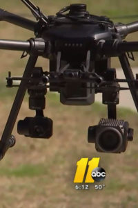
MOORE COUNTY (WTVD) — A missing child has been located thanks to the Moore County Sheriff’s Office’s drone.

Two lost hikers and their yellow Labrador were located with the help of a drone after they accidentally wandered off a trail in Pike National Forest in Colorado.
Read the Full Article
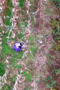
An 81-year-old woman who was lost in a North Carolina cornfield on Sunday was found in less than 30 minutes after officials used a drone to locate her, a video released by police showed.

